

Sunshine Coast Trail
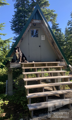
The Sunshine Coast Trail (SCT) is Canada’s longest hut-to-hut hiking trail at 180km and is located around Powell River on British Columbia’s Sunshine Coast. Just 135 kilometres northwest of Vancouver, Powell River has endless lush mountains draped in hemlock and cedar forests that run alongside the Georgia Strait. This area feels far more remote than it actually is thanks to the two ferries that are required to get there. In addition to the Sunshine Coast Trail, there is world-class sea kayaking and sailing in Desolation Sound, mountain biking, fishing and the 57-kilometre Powell Forest Canoe Route that I completed two days after finishing the Sunshine Coast Trail. After a short day hike in 2022 to Manzanita Hut (which is one of 16 shelters along the length of the trail) I immediately put the Sunshine Coast Trail on my ‘to-do list’.
The Sunshine Coast Trail was created by joining several existing trails which the infamous BOMB squad worked on over the years since 1987. BOMB squad is short for ‘Bloody Old Men's Brigade’ which started with three retirees building and clearing older trails around Powell River. The median age of the group is in the high sixties and now consists of twenty-seven people, some as old as eighty. It's thanks to these passionate folks that the building blocks of the Sunshine Coast Trail were born and then in 1992 the qathet Parks and Wilderness Society (qPAWS) was formed to facilitate their work. qPAWS started connecting more trails and in 1997 two provincial parks and a protected areas were created. This was the formation of the Inland Lake Park, Malaspina Park and Duck Lake Protected Area. Thanks to funding from the Island Coastal Economic Trust in 2009 the construction of shelters and huts began, making it easier for people to complete the entire 180km length of the trail. For those that that prefer to section hike the Sunshine Coast Trail there are over two dozen access points via various logging roads which provide easy access to break the trail up into smaller section.
- SHOW THE REST OF THE REVIEW / PHOTOS / VIDEOS
-
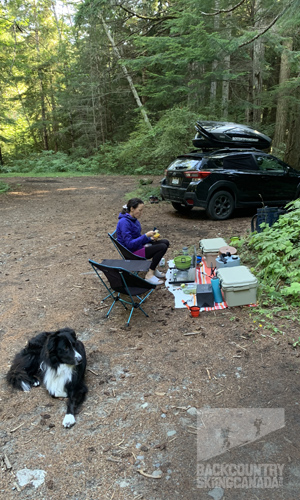
While most people take 8-10 days to complete the Sunshine Coast Trail, I decided to complete the entire length of the trail in only five days by fast-packing it with support. I broke the trail up into manageable 35km sections (on average) which would allow me to hike with only a day pack and then rendezvous with my support each afternoon to rest, eat and sleep. While these days would be long and strenuous going light and fast was much more appealing than carrying a heavy pack as most people do. With my trusty K9 by my side, I waited for a solid weather window and then set out with Sunshine Coast Shuttles to access Sarah Point. A shuttle by boat or 4WD is required to get to the start of the trail as the last few kilometres of the road to Sarah Point are worse than bad, they will destroy your car so it’s not worth risking. I met my ride in Lund and within an hour I was at Sarah Point and ready to start walking. If you need a ride from the end of the trail or any point in between then give Sunshine Coast Shuttle a call as they can pick you up and drop you pretty much anywhere you need.
Throughout my five-day hike, I tracked the entire route in five sections thanks to my Suunto Vertical Titanium Solar GPS Watch. I also carried along a first aid kit which I used for foot repair, a cell phone which had service on a surprising amount of the trail—but not everywhere, 3-3.5 litres of water and spare food, foul weather gear and my trusty Garmin InReach Messenger. The Inreach allowed me to communicate while out of cell coverage and also send out an SOS message if the proverbial shit hit the fan, which thankfully it never did. While the trail is never far from a logging road or secondary exit trail, it is still very remote in sections and there were days when I was easily 15km or more from any easy exit point. I also didn't see anyone on trial for three of the five days which just stresses how important the right preparation prior to starting the trail is along with the correct emergency supplies, communication device(s) and first aid kit. For navigation I used my Suunto Vertical Titanium Solar GPS Watch which has built-in maps, I also carried a paper map along with the free Avenza Digitial Maps that track you along the entire length of the trail broken out into geo-located sections. I also uploaded the trail's GPX file into Fatmaps as a backup just in case these other systems failed me. While the route was very well signed and there were mileage markers every kilometre, I constantly had to check my location with the Avenza Maps to ensure I was on track. This is especially true when I encountered three re-routes that took me off trail quite a ways and were not nearly as well marked. The total distance hiked was 170km over the five days, taking a total of 37 hours and 28 minutes and covering a total elevation gain of 7,829m / 25,685.7ft.
Day One:
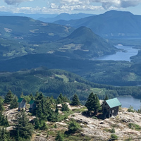
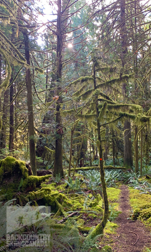
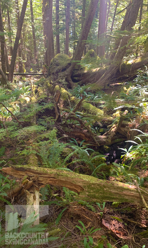
My first day on the trail was meant to be a warm-up with only 30km to hike and with an early drop off by Sunshine Coast Shuttles at Sarah Point by 8:00 am I was ready to take on the trail. Within the first 3 minutes of my hike, I was greeted by a pod of dolphins swimming just off Sarah Point, I considered this a very good omen for the journey to come as I am pretty sure not everyone gets a send-off like this. Since the first 15 kilometres of the hike are within Malispina Park the landscape is incredibly lush and thanks to the rain which fell the previous two days I was fortunate to see the forest in all its glory. This would turn out to be my favourite section of the hike as the impressive display of ferns, moss and old-growth trees was truly magical. After a few hours, I stopped at Wednesday Lake for a much-deserved swim as it was getting hot out and the moisture in the northeast-facing valleys made it feel quite muggy. After three and a half hours of hiking, I had covered 16.7km and I arrived at Manzanilla Hut which was quite popular with day hikers when I arrived. Up until this point, I only passed one other group of two hikers so the trail was quite peaceful and it was nice to be solo, other than my dog who was faithfully leading the charge. Feeling full of energy after a short lunch break at Manzanilla Hut I was promptly stung by a wasp which I was warned about thanks to the Sunshine Coast Trail Facebook group which is updated regularly with helpful information. I carried on and was treated to some equally beautiful sections of the trail just before my stop for the day at Homestead Creek Recreation Site. Located on Southview Road and easily accessible by any kind of vehicle means that Homestead Creek Recreation Site is an ideal place to camp. On the last few kilometres of the trail before Homestead, you'll find a waterfall to rinse off in and some of the largest old-growth trees I had seen on the trail thus far.
 SPECS:
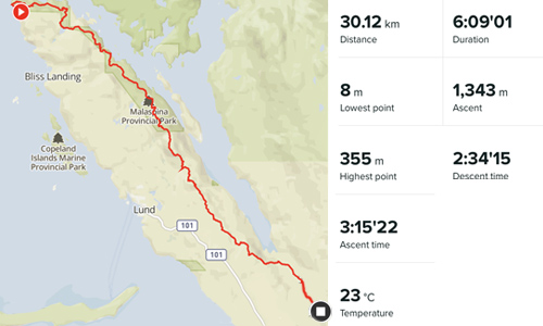
Distance: 30.12km
Hiking time: 6:09
Elevation Gain: 1,343m / 4,406ft
Start / Stop: Sarah Point to Homestead Creek Recreation Site on Southview Road
Suunto Vertical GPS RouteFern Crossing with all it's coastal beauty.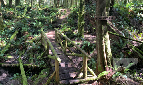 Bliss Portage Hut.
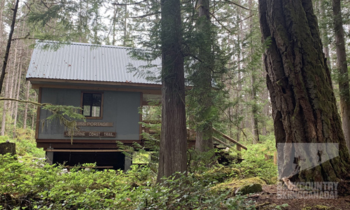 Manzanita Bluff Hut.
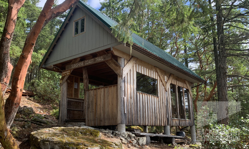 Happy trail dog and happy hiker to have arrived at Homestead Creek Recreation Site after a 30km day.
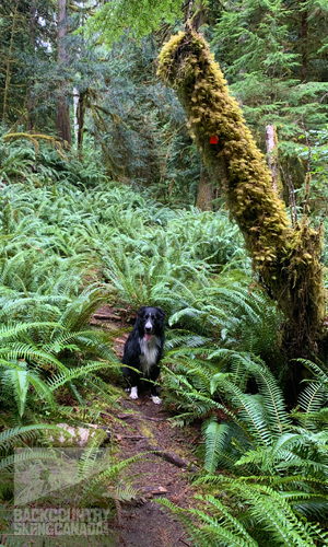
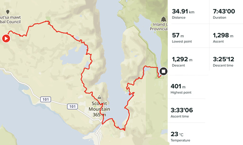
Day Two:
After a good rest, meal and sleep it was an early start to the day in order to get to Inland Lake Park Camping Area which was 35 kilometres away. The trail started with a steep climb to Rieveley Pond and after crossing a logging road I woke a bear from slumber in the bushes and he/she promptly ran away. Good bear. The highlight of the trail would turn out to be the canyon on the way down to Theyeth Lake. It contained several waterfalls that were still running with water despite the hot summer weather. Gorge Falls, Bandit Falls and Sylph Falls while not flowing as mighty as they would in spring were still a good distraction from the trail in front of my feet and a place for Lumin (my furry hiking companion) to get a drink and have a soak. Once I arrived at Powell Lake I decided to take a lunch break before heading to Mowat Bay Park. It turned out to be a good idea as while I ate I was visited by a curious fawn and doe, unbeknownst to them we simply watched and enjoyed the show. After Mowat Bay Park, the climbing continued and what looked like to be a relatively flat two days of walking turned out to total more than 1,300 meters/day. Day two would not be complete without another wasp stinging me, this time on my arm. Pushing on from Haywire Bay Campground it was a short jaunt up and around Lost Lake to the more developed trail that circumnavigates Inland Lake. Although I could see the campground on the other side of the lake it was still a solid kilometre or more until I could rest for the day.
 SPECS:
Distance: 34.91km
Hiking time: 7:43
Elevation Gain: 1,298m / 4,258ft
Start / Stop: Homestead Creek Rec. Site on Southview Road to Inland Lake Camping Area
Suunto Vertical GPS RouteRieveley Pond Hut.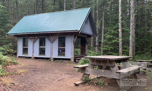 Views of Powell Lake.
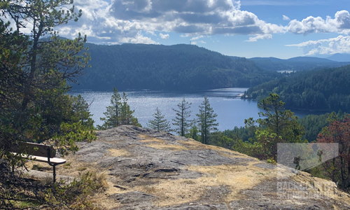 Gorge Falls and more incredible forest views.
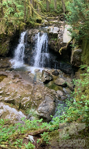
Day Three:
A swim in the warm waters of Inland Lake, some nurturing food and lots of rest prepared me well for day three as there was a lot of climbing ahead on what would turn out to be my biggest day of vertical for the trip. With a bridge being permanently closed on the trail ahead the park ranger directed me up an old logging road that reconnected with the trail just in time for the most beautiful part of the trail. Given that I was once again hiking in a park (this time Inland Lake Park) the surrounding nature was lush, green and abundant with large old-growth trees everywhere. This climb up to Confederation Lake was to be the second most beautiful part of the hike so far and I soaked it all in while getting more kilometres under my boots and more vertical behind me. After a quick two hours of hiking, I met a large group preparing their morning coffee and breakfast at Confederation Hut which is located at the east end of Confederation Lake. After a brief chat, I continued on as I wanted to complete most of the climb up Tin Hat Mountain before the heat of the day arrived. After a long descent down to Fiddle Head Landing the next climb loomed ahead of me in the form of Tint Mountain. Arguably the most scenic of all the mountains on the trail, it is not the tallest as that honour goes to Mount Trobridge which I will get to see on day five. Just as I was regaining my energy to tackle the climb to the 1,185m / 3,888ft summit of Tin Hat Mountain I was thrown a curveball, a 3km detour around active logging. While this added kilometres to my day, it would not be the last of these re-routes so all I could do was accept what the trail threw at me never knowing what was next. After a long steep climb, I was rewarded with incredible 360° views of Georgia Strait and the chain of lakes that makes up the Powell Forest Canoe Route which I would be tackling after completing the Sunshine Coast Trail. With renewed energy and a brief lunch break atop Tin Hat Mountain, I decided to save some distance and take the shorter west route down from Tin Hat Mountain to Spring Lake where I would rendezvous with my support for the night.
 SPECS:
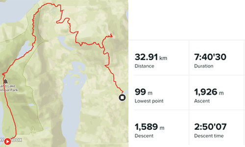
Distance: 32.91km
Hiking time: 7:40
Elevation Gain: 1,926m / 6,319
Start / Stop: Inland Lake Camping Area to Spring Lake Parking Lot
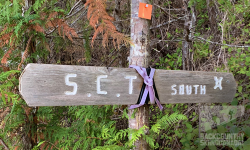
Suunto Vertical GPS RouteConfederation Lake Hut.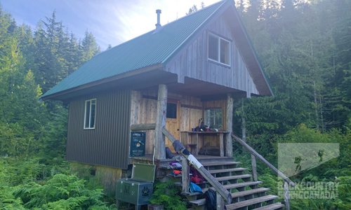 The dreaded trail re-route sign and nature giving some love back.
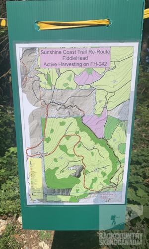
 360° Panoramic views from the summit of Tin Hat Mountain.
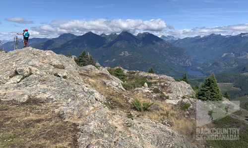 Tin Hat Mountain Hut.
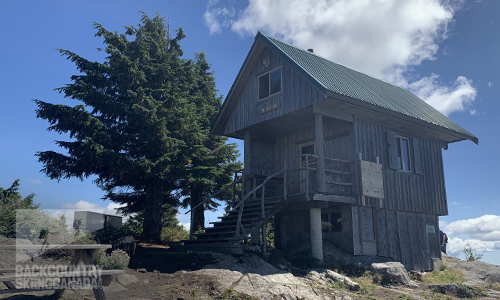 Tin Hat Mountain Hut surrounded by views of the Powell Forest Paddle Route.
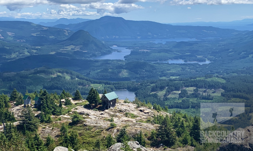
Day Four:
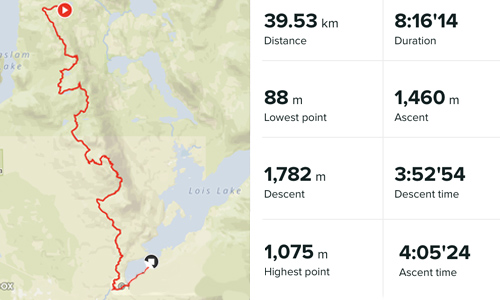
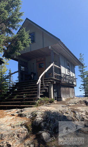
Day four was the crux of the trail for me, 98km in and I was feeling the efforts of my work thus far and knew this would be a tough day as it was the longest at pretty much 40km. this was also the least scenic day as there was to be a lot of logging and clear-cuts along the trail which provided a stark contrast to the previous few days and how lush and unspoiled they were—thanks to parks. A good portion of this part of the Sunshine Coast Trail is made up of old ATV and logging roads which were a pleasure to walk on after the steep root-filled sections, my feet were happy. The vertical on this day came in short bursts but there was no shortage of it and combined with the almost 40km I had to cover I was sure to be tired once I arrived at Lois Lake. The high point, literally and figuratively was Walt Hill as it provided great views of the valley floor and distant mountains. The Walt Hill Hut was unoccupied at the summit and I would not see a single person on the trail over the course of the day. After more clear cuts, another bear sighting and another re-route I was happy to see the waters of Lois Lake but it would still be several more kilometres until I could peel off my hiking shoes and go for a much-needed swim.
 SPECS:
Distance: 39.53km
Hiking time: 8:16
Elevation Gain: 1,460m / 4,790ft
Start / Stop: Spring Lake Parking Lot to Lois Lake Camping Area
Suunto Vertical GPS RouteElk Lake Hut.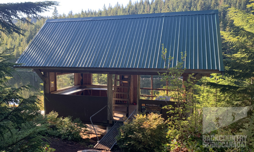 Massive old-growth stumps abound along the trail.
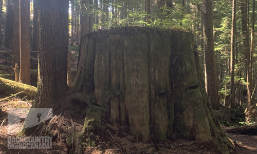 Still happy trail dog and Walt Hill Hut.
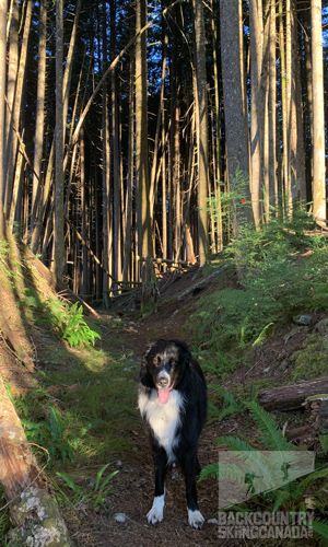
Day Five:
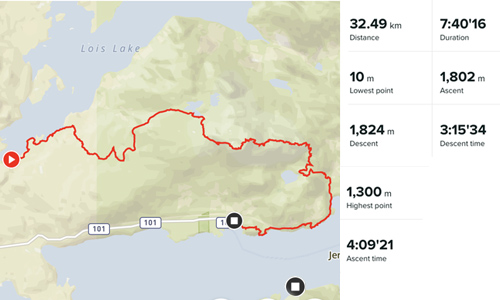
Happy to be on the last day of the hike with my body slowly showing signs of wear and tear. However, there was still one mountain to climb and at 1,300m/4,265ft this day would not be a gimme as it would have to be earned. Like the previous day, I would not see a soul on the trail all day and just put my head down with the goal of lunch on the summit. After logging several kilometres on bike trails and old roads I reached the summit in just four hours and was happy to know it was all downhill from here—or so I thought. With black flies and no view at the summit, I carried on and had lunch on the trail at Rainy Day Lake after most of the descent was behind me. With wafts of sea air filling my senses I knew that I was not far from the ocean and I looked forward to the ocean-side hike. This section, however, is where more elevation would be piled onto the total as most of the trail from Fairview Bay Hut to Shelter Bay is not flat, nor is it along the ocean. After another hour of walking the end was in sight, I hastened my pace and climbed the final 100m hill to the end of the trail at kilometre 180 (170 for me as I took a shorter alternate route off of Tin Hat Mountain). Glad to have completed the goal I promptly backtracked down the trail to “What’s the Point” Point for a celebratory swim in the ocean. So amazingly refreshing. On the leisurely walk back to the car I received wasp sting number three but I was determined to not let that overshadow what I had accomplished and I looked forward to the second leg of the adventure to start in only two days—the Powell Forest Canoe Route.
 SPECS:
Distance: 32.49km
Hiking time: 7:40
Elevation Gain: 1,802m / 5,912
Start / Stop: Lois Lake Camping Area to Shelter Bay Finish
Suunto Vertical GPS RouteGolden Stanley Hut and Mount Troubridge Hut.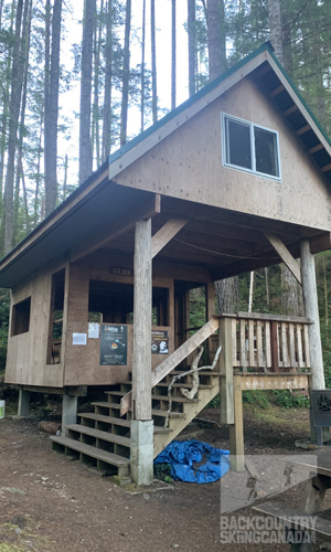
 Thanks to the BOMB Squad and qPAWS for making this trail a reality.
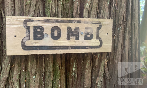 Ocean views of Jervis Inlet and a very happy trail dog camouflaged in a stream.
 Fairview Bay Hut.
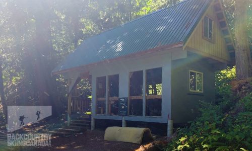 The end of the Sunshine Coast Trail at Saltery Bay, 5 days,170km and 7,829m of gain and still smiling.
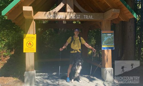
Distance: 170kmTOTALS:
Time: 37:28
Elevation Gain: 7,829m / 25,686ft
Verdict:
The Sunshine Coast Trail has been the longest hike I’ve completed to date and while I’m an avid hiker and experienced mountaineer, the Sunshine Coast Trail still tested my limits. Before starting the hike I spent a few months training by hiking longer distances with considerable elevation gain and I was glad I did as five days of 35km and 5,000ft of gain (on average) proved to be challenging. My approach to fast-pack the trail with support was one that worked extremely well as it allowed me to cover longer distances relatively fast and my goal of maintaining a pace of 5km/hr was achievable thanks to the lightweight pack on my back. While the Sunshine Coast Trail isn’t blessed with high-elevation views and glaciers like Mount Rainier, never-ending ridge views like the Rock Wall Trail, an exotic location like Lobuche Peak in Nepal or coastal exposure like the Juan De Fuca Trail—it does have a certain magic all its own. The variety of landscapes and wildlife that you’ll experience on the Sunshine Coast Trail changes by the hour depending on where along the trail you are and on what aspect you are hiking. The forest bathing opportunities are never-ending, there are lush old-growth fern valleys on northeast aspects complete with waterfall canyons and views straight out of the Ewok scene in Return of the Jedi Movie. High mountain vistas come later along the trail where you are treated to 360° panoramas of the chain of lakes and ocean below. The trail typically skirted around clearcuts but it was amazing to see the stark contrast of how the environment differs when the trees are removed. The land is dry, barren and seemingly lifeless but then you hike through replanted areas and you can see how nature bounces back with abandonment and things slowly start to resemble their former beauty.
I would highly recommend the Sunshine Coast Trail to anyone interested in experiencing the beauty of the Pacific Northwest. While the entire trail is an undertaking for most, it can be broken out into smaller sections to accommodate anyone's schedule, including weekend warriors. And, if you struggle with carrying weight I’d recommend planning your own fast-packing adventure to make the entire experience much more comfortable. However you approach it, the Sunshine Coast Trail is a must-do for any hiker. Start with a day hike up to one of the many accessible huts to admire the tireless work of the BOMB Squad and the qathet Parks and Wilderness Society (qPAWS) and I’m sure you’ll be hooked just as I was. Enjoy the walk.
 |
PROS:
|
 |
CONS:
|
SPECS:
Price: Free (other than the shuttle drop)
Distance: 180km
Time: 8-10 days (or 5 fast packing)
Location: Powell River, on the Sunshine Coast of British Columbia
Landscape 1.5/2
Challenge 2/2
Huts 2/2
Access 1.5/2
Value 2/2

Did we miss something? Are we totally out to lunch? Let us know what you think. People like/dislike gear for different reasons so chime in below and we'll get a well-rounded evaluation. You'll need to login or register before you can comment but it only takes a few seconds, then you're good to go.
Leave a Comment: