






Looking for more information on current conditions and found these posts on the CAC site, for the full reports check out their site.
Airy Ck., Vallican, Slocan
2010-02-13 13:15
We had witnessed a slide minutes earlier and were beating a hasty retreat to safer terrain below treeline when the first skier remotely triggered this little baby on a commonly skied run. Old ski tracks were visible all around the incident. Debris were 1 - 2 m deep at the deposition zone and many blocks of snow remained in the path afterwards. The SZ may have been 30 degrees briefly but the slope on average is 25 degrees or less.. This avalanche is indicative of other avalanches.
75m wide; ran for 200m; average slab depth of 50cm.
Here is the comments on the info on that earlier report:
This slide occurred as we approached ona flatter slope to the climbers right of the path. We had heard some small settlements starting at treeline and decided to walk up a little further. We were on a 20 degree slope adjacent to the slide path. It is possible that we remotely triggered it but due to time of day and solar heating, it may have been natural too. The area where the slide occurred is not generally skied but it does see some traffic and runs out on to a lower slope that is skied more regularly. The crown varied from 10 to 80 cms, averaging 60 cms. As we skied down, the first skier remotely released another slide in a highly skied area.. This avalanche is indicative of other avalanches.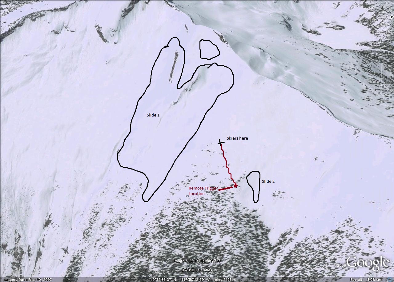
Kootenay Pass
Skied up Cornice Ridge today (Feb 13) then over towards Missle Ridge, (RCMP Repeater) dropped down into Lost Creek (east aspect) towards powerlines. We had some settlements happenning in sheltered areas in the trees and there were long cracks extending down the hill after a settlement. Slope was about 20 degrees so it didn't slide. Layer that was failling was down about 25-30 cm.
