






It's a foundational question asked by backcountry skiers and introduced in every avalanche education course.
However, recently published research suggests that (1) we're not very good at measuring slope angle and, on top of that, (2) our measuring tools aren't very accurate.
Why does this matter?
It matters because, according to Avalanche Canada:
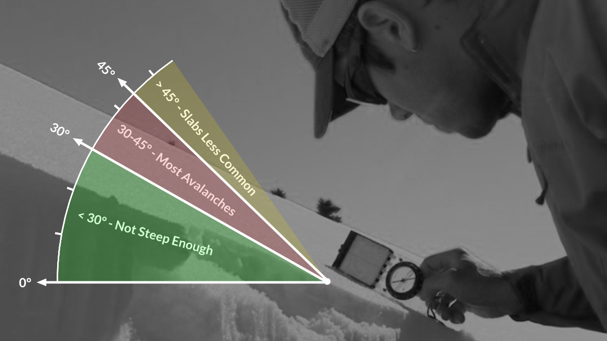
Slope angle is the most significant characteristic of an avalanche slope. The vast majority of avalanches take place on slopes between 30° and 45°, which is about the steepness of a black run on a ski hill. It’s also the preferred terrain for many backcountry enthusiasts.
Avalanches can happen on less steep slopes between 25° and 30°, but they are not as common. On slopes steeper than 45°, snow usually slides away frequently, so slabs are less likely to form. Keep in mind that an avalanche that starts in steep terrain can run across a flat slope and even travel uphill.
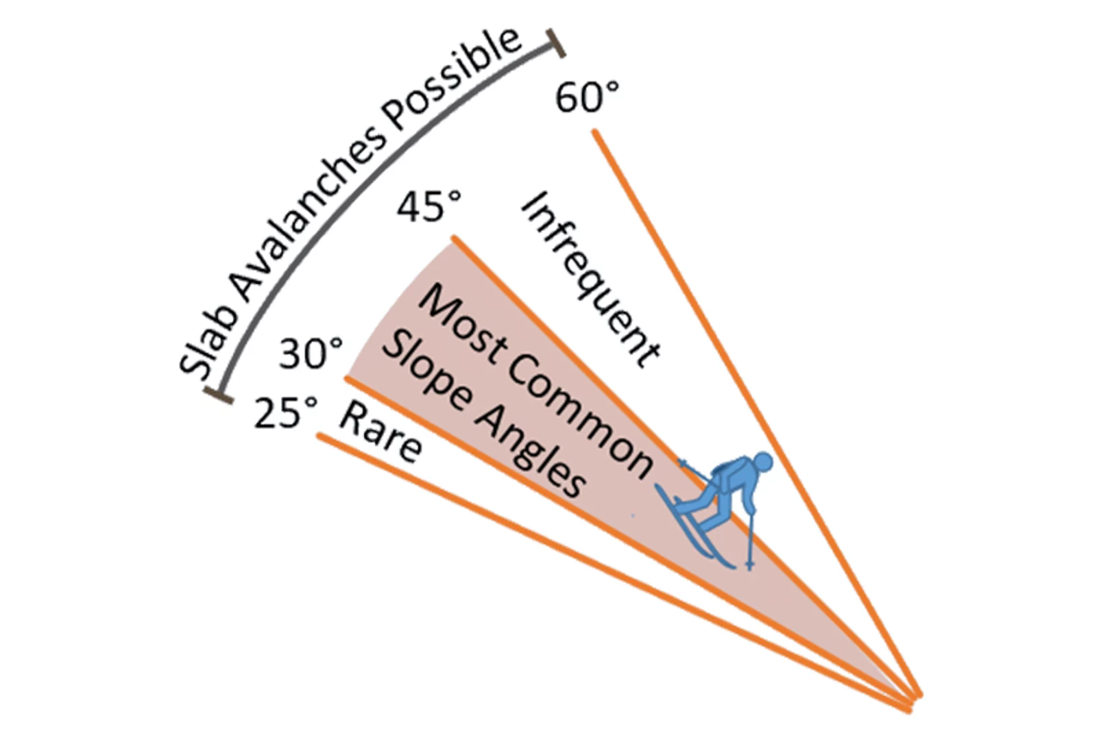 Image from Avalanche Canada (Avy Savvy Online Course).
One of the most discussed papers at the recent International Snow Science Workshop (ISSW) in Bend, Oregon, was Slope Measurement for Humans: Inclinometer Error and Risk Communication by Dr. Ian McCammon (full paper available here).
Between 2002 and 2019 Dr. McCammon examined three primary questions related to slope angle measurements:
- How well can we measure slope angles,
- Does slope angle measurement error affect risk management, and
- Can simple decision strategies overcome these problems?
So, we're not very good at measuring slope angles and our tools (in ideal conditions) are only accurate to within 4 degrees.
So what does this means for backcountry skiers and people traveling in avalanche terrain?
In an article for The Avalanche Review McCammon suggests three action points (included below as an extended quote):
Action 1: Check your inclinometer.
Step 1: Using a pocket level find a level surface or edge and check that both directions show as level. Step 2: Cut out a triangle from a square corner of cardboard where the diagonal is exactly twice the length of the shortest side. Step 3: Set your triangle on the level edge and your inclinometer on the sloping edge. It should read exactly 30 degrees. If it doesn't, write down the correction you will need to make in your slope measurements (e.g. "Add 1.5") on the back of your inclinometer.
Action 2: Improve your accuracy with multiple measurements.
Instead of relying on a single slope measurement when making a critical route-finding decision, average two or three readings made by different people using different inclinometers. The result can reduce your measurement uncertainty. However, getting much below +/- 2 degrees probably isn't practical.
Action 3: Good risk management is about the big picture. Small differences in slope angle are the little picture.
Many inclinometers for the backcountry display slope measurements in single degreees, resolution that invites the illusion that avalanche risk can be managed with that same precision. But measurment error can easily hide large differences in avalanche risk. So rather than being drawn into the small world of slope angle differences, it's critical to rememebt that the bigger picture is more important.
McCammon emphasizes the need to focus our terrain use conversations on how much uncertainty we have about the snowpack and what terrain margins we need to build to have a safe and fun day.
As Warren Buffett once said, "It's better to be approximately right than precisely wrong."
Jerry Isaak is an Associate Teaching Professor and the program lead for ski touring in the Adventure Studies Department at Thompson Rivers University in Kamloops, British Columbia. He is an AMGA certified Ski Guide and has guided backcountry ski adventures in Iceland, Kyrgyzstan, Japan, and throughout the United States and western Canada.
