

SITE LOGIN
- REVIEWS
- NEWS
- STORE
- ROUTES
- LODGING
-
VIDEOS
- 2022/23 Gear Reviews
- 2021/22 Gear Reviews
- 2020/21 Gear Reviews
- 2019/20 Gear Reviews
- 2018/19 Gear Reviews
- 2017/18 Gear Reviews
- 2016/17 Gear Reviews
- 2015/16 Gear Reviews
- 2014/15 Gear Reviews
- 2013/14 Gear Reviews
- 2012/13 Gear Reviews
- 2011/12 Gear Reviews
- 2020 Outdoor Retailer
- 2019 Outdoor Retailer
- 2018 Outdoor Retailer
- 2017 Outdoor Presscamp
- 2017 Outdoor Retailer
- 2016 Outdoor Presscamp
- 2016 Outdoor Retailer
- 2015 SIA Show
- 2014 Outdoor Retailer
- 2013 SIA Show
- 2012 Outdoor Retailer
- Tips and Tricks
- Backcountry Skiing
- SAFETY
- ABOUT
TOP VIDEOS
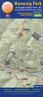
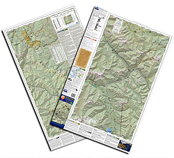
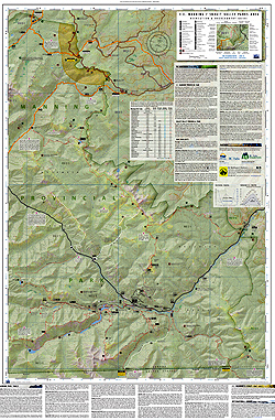
Manning Park Map
This map covers E.C. Manning and Skagit Valley Parks with beautiful shaded relief and detailed 25m contours. GPS-Ready UTM & Lat/Long for trails, routes and distances complete with hike and traverse descriptions.
|
|
We partnered with BC Parks to create this exceptional 1:50,000 scale map. It's the ONLY dedicated hiking, biking, horse riding, and XC/backcountry ski map available for British Columbia's crown jewel, Manning Park, and its beautiful cousin, Skagit Valley Park. These two parks share boundaries, span a huge area and offer a plethora of recreational and nature-based activities - we've got them covered. These picturesque parks harbour a legacy that dates back to British Columbia's early days as a province - you can still hike/ride along the many historic horse trails built by British engineers in the mid-1880s - and we've identified these trails (btw, they've all been GPS'd) so you can travel back in time as you make your way into the heart of Manning Park.
Size: 24" x 36", double sided, colour map and info guide - folded to 4" x 9"
Media: Yupo synthetic paper
Weight: approximately 55 grams per map
PRICE: $23.95
Copyright © 2009-25 Backcountry Skiing Canada. All Rights Reserved.
