




• Weekly avalanche conditions report
    Weekly Episode

    Avalanche Conditions Report

    Weekly snowpack summary covering Rogers Pass, the Selkirks and the Canadian Rockies. Published every Friday throughout the season.

    Listen Now →

    Weekly avalanche & safety updates throughout the season

  • BSC Guide Books
    Proprietary Content

    BSC Guide Books & Maps

    Researched and written by our team. Printed guides and georeferenced digital maps for Canada's best backcountry terrain.

    Shop the Store →

    Printed guides + georeferenced digital maps — all authored by BSC

  • BSC Membership

    Access 300+
    Full Routes

    Subscribe to Backcountry Skiing Canada and unlock complete route descriptions, trailhead details, approach beta, seasonal conditions and linked digital maps — for every route we've documented across Western Canada.

    • 300+ full route descriptions with trailheads, approach notes and descent options
    • Georeferenced digital maps — Gaia GPS and CalTopo compatible
    • ATES-rated and updated each season with current conditions beta
    • Support independent backcountry skiing content since 2009
    Subscribe to BSC Browse free content →

    Route details also available in BSC printed guidebooks

  • Know Before You Go

    Check Today's Forecast

    Real-time avalanche danger ratings updated daily by Avalanche Canada. Always check before heading out.

    View Forecast →

    Avalanche awareness saves lives

  • Know Before You Go

    Check Today's Forecast

    Real-time avalanche danger ratings updated daily by Avalanche Canada. Always check before heading out.

    View Forecast →

    240+ videos — gear reviews, conditions reports & backcountry edits

LOGIN

Spring Trail Conditions Around Whistler

  • 2014-05-06 10:57:10

    Anxious to get out on the trails? To get the hiking legs in shape, here are your best bets for the shoulder season in the Whistler/Pemberton area.

    1. Tenquille Lake Trail, from the bottom of the valley. (I wrote about this in my last Tues post here: http://backcountryskiingcanada.....tenquille) This is the longest stretch of uphill snow free training I have found in this area – it'll get your legs and lungs burning and there are no mosquitos yet.

    2. The new Mt Currie trail. Another steep, south facing sunny hike with lots of snow free elevation gain. You'll need 4WD and a few route finding skills here, but it's beautiful and dry the whole way up. The trail and access road pass through an active logging area so Sundays are probably the only day that it's possible to get in here right now.

    3. Garibaldi Lake trail, from Rubble Creek. On Sunday the snow line was at 4.5km so even if you just go to this point and turn around, it's a great hike. The trail is so packed down from winter traffic you could walk or snowshoe the rest of the way without any trouble too.
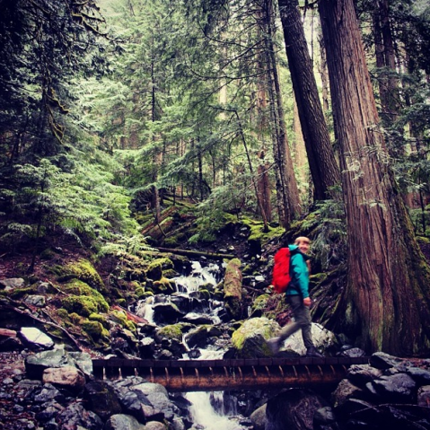
    Emily Haggar Garibaldi Lake Trail

    4. Shorter hikes around Whistler: The Lost Lake trails are pretty much snow free aside from the odd patch. There are lots of trails in Cheakamus as well – Suspension Bridge, Sea to Sky trail, Logger's Lake that are good for the early season hikes.

    Around Pemberton, the whole hill of hiking / biking trails in the MacKenzie area up to the Paraglide Launch are snow free too.

    Next up will be Cheakamus Lake (below). I drove part way up the access road on Sunday but it was too snowy to go the whole way still. Maybe another week or two. This is one of the best trails for spring hiking.
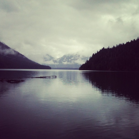
    Emily Haggar Cheakamus Lake

    Wedge, Helm Creek, Brandywine, Rainbow and Singing Pass all melt out much later, but you can count on the ones above, or head north into the Chilcotin to find some dry hikes too!


  • 2014-11-01 10:14:01

    The Whistler Disc Golf Course and associated trails at Lost Lake Park are closed from November 1 to 15 for tree pruning and vegetation management by BC Hydro.