

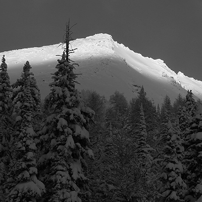
Welcome to Episode 7 of the 23/24 Avalanche Conditions Report with Jason Wishlow, brought to you by Whitewater Ski Resort, Backcountry Skiing Canada and State of the Snowpack. It's February 29, 2024 and winter is back!
We are in the middle of a significant storm with a positive pattern change for producing snow. The current storm has produced over 40cm so far with moderate to strong SW winds at ridge-top elevation.
This has created a storm slab which is up to 60cm deep in lee features producing a large natural avalanche cycle. A melt freeze crust from the last atmospheric river is now up to 2 metres deep in areas of the snowpack. This has a layer of weak faceted crystals on it and has produced avalanches up to size 3 in Ymir Bowl. As load from the new storm slab increases, the likelihood of this layer producing extremely large and destructive avalanches is significant. In areas north of us, this layer has been producing natural, remote, and sympathetic avalanches up to size 4.
With these conditions, Avalanche Canada has issued a Special Public Avalanche Warning (SPAW) for most of BC and past the Alberta border. The avalanche hazard will remain HIGH to CONSIDERABLE through the weekend. Please avoid travel in avalanche terrain until conditions moderate.
Stay tuned for Episode 8 and be sure to always check Avalanche Canada before heading into the backcountry!

-
Reviews published since 2009 — updated every season
-
Weekly Episode
Avalanche Conditions Report
Weekly snowpack summary covering Rogers Pass, the Selkirks and the Canadian Rockies. Published every Friday throughout the season.
Listen Now →
Weekly avalanche & safety updates throughout the season
-
Proprietary Content

BSC Guide Books & Maps
Researched and written by our team. Printed guides and georeferenced digital maps for Canada's best backcountry terrain.
Shop the Store →
Printed guides + georeferenced digital maps — all authored by BSC
-
-
Know Before You Go
Check Today's Forecast
Real-time avalanche danger ratings updated daily by Avalanche Canada. Always check before heading out.
View Forecast →
Avalanche awareness saves lives
-
Know Before You Go
Check Today's Forecast
Real-time avalanche danger ratings updated daily by Avalanche Canada. Always check before heading out.
View Forecast →
240+ videos — gear reviews, conditions reports & backcountry edits

Avalanche Conditions Report for Feb 29th 2024
-
 2024-02-29 15:47:33
