






Looking for some something new to do in the Bow Valley this weekend? A brand new 7 pitch bolted route has just gone up on Mt Cascade's buffalo crag in Banff national park. The route goes at 5.7 and was established by Brandon Pullan and Gaby James just this July. The beta goes like this according to Gripped Magazine. http://gripped.com/news/wheat-.....n-rockies/
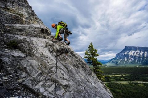
Photo: Gripped Magazine
“Wheat Kings 5.7 225 meters
Approach: Park at Cascade Falls parking area on the Lake Minnewanka Road. Take trail south past air strip into a forest heading west past one path up a slope. After 15 minutes take a faint trail right past a rock with a cairn that is flagged with orange tape. Follow the trail up a slope rising left to a big boulder on the left of the trail after about five minutes. Follow the flagged path up to the base of the wall. There is no trail, but the flagging tape follows the easiest way to the start of the route. About 45 minutes from the car. Some pitches are between 30 and 35 meters, but they are rounded up to 35. The route is new for July 2016 and has dirty sections. Beware of loose rock. Gear: Eight quickdraws, two extendable draws, and 70-metre rope.
Pitch One: Climb up and left past two bolts and follow a foot rail up and right past a third bolt. Climb the corner to a bolted belay at a tree. (5.5 30 meters, four bolts)
Pitch Two: Climb good rock left of the corner past two bolts and up and left avoiding dirty rock on the right. Angle up and right to a fourth bolt. Follow a crack up and right to a break in the rock and left to a ledge with a tree and belay. (5.6 35 meters, seven bolts)
Pitch Three: Step up and left and then follow fun features to a ledge. Take a faint crack right up to a belay. (5.7 35 meters, eight bolts) Note: There is an endangered whitebark pine far left of the second bolt, don’t damage or remove.
Pitch Four: Step up and left to a bolt. Continue up to a ledge and head left to a belay. (5.4 20 meters, two bolts)
Pitch Five: Up two short walls past two bolts to a ledge. Up and right to a corner that you climb for a few moves and then step left onto a pillar. Up pillar to a bolt and then right on low-angle rib to belay. This is the Pretty Things belay ledge where you can see Mount Louis and most of the Bow Valley. (5.6 40 meters, five bolts)
Pitch Six: Up a steep move to a ledge and up the corner above past a hard-to-see bolt. Continue up easy ground to a belay near a tree. (5.6 30 meters, four bolts)
Pitch Seven: Up the rib past bolts to a break in the rock on the left. Up easy climbing to the final anchor. (5.5 35 meters, five bolts)
Descent: Rappel route with 70-metre rope using a rappel-only anchor between the top of pitch five and three. Alternatively, walk off a flagged trail by heading up about 100 meters after the route and then left over small rock steps until you take the forest down. “
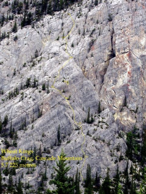
Photo: Gripped Magazine
Personally, I think routes like these are something the climbing community is asking for. It's a great introduction to big routes without the commitment of a stiff grade or having to place your own protection. This is something that is currently lacking here in Revelstoke, again just my opinion and I suppose maybe I should do something about it or stop whining. So grab a friend and your climbing shoes and show this new route come love and let us know when you do!
