




• Weekly avalanche conditions report
    Weekly Episode

    Avalanche Conditions Report

    Weekly snowpack summary covering Rogers Pass, the Selkirks and the Canadian Rockies. Published every Friday throughout the season.

    Listen Now →

    Weekly avalanche & safety updates throughout the season

  • BSC Guide Books
    Proprietary Content

    BSC Guide Books & Maps

    Researched and written by our team. Printed guides and georeferenced digital maps for Canada's best backcountry terrain.

    Shop the Store →

    Printed guides + georeferenced digital maps — all authored by BSC

  • BSC Membership

    Access 300+
    Full Routes

    Subscribe to Backcountry Skiing Canada and unlock complete route descriptions, trailhead details, approach beta, seasonal conditions and linked digital maps — for every route we've documented across Western Canada.

    • 300+ full route descriptions with trailheads, approach notes and descent options
    • Georeferenced digital maps — Gaia GPS and CalTopo compatible
    • ATES-rated and updated each season with current conditions beta
    • Support independent backcountry skiing content since 2009
    Subscribe to BSC Browse free content →

    Route details also available in BSC printed guidebooks

  • Know Before You Go

    Check Today's Forecast

    Real-time avalanche danger ratings updated daily by Avalanche Canada. Always check before heading out.

    View Forecast →

    Avalanche awareness saves lives

  • Know Before You Go

    Check Today's Forecast

    Real-time avalanche danger ratings updated daily by Avalanche Canada. Always check before heading out.

    View Forecast →

    240+ videos — gear reviews, conditions reports & backcountry edits

LOGIN

Wedgemount Trail Re-Route

  • 2014-05-13 10:07:05

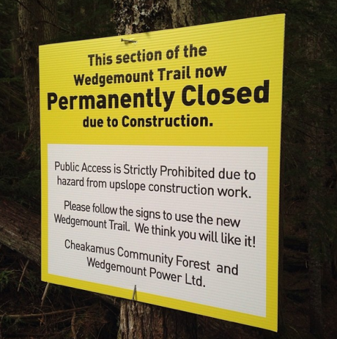
    I drove up the road to the Wedgemount Lake Trail yesterday to find the parking lot had turned into a giant pile of wood chips, logging trucks and noise.

    There are a bunch of little signs pointing you to a new trailhead further down the road, and a new parking lot. The first 1.5kms of this trail are now permanently closed, and a new trail has been cut a little to the north.
    Emily Haggar Wedge

    This used to be one of the most peaceful places you could find around Whistler - huge stands of forest, total silence, not too many crowds (usually). Now you will find yourself in the midst of a logging operation to clear a pathway for Wedgemount Power to tap the river coming down from Wedgemount Lake. Aside from the grinding machinery, the chainsaws and the sound of falling trees crashing like thunder will be with you on your hike up.

    The new trail re-route is pretty good in and of itself, but it's really disappointing to see the forest begin destroyed in this gorgeous valley. I guess there is no holding back 'progress'.

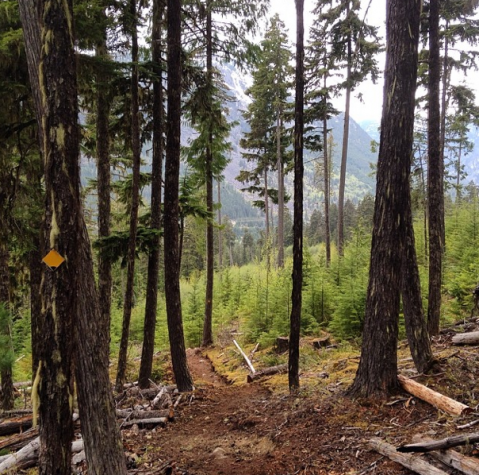
    This is the new trail:
    Emily Haggar Wedge

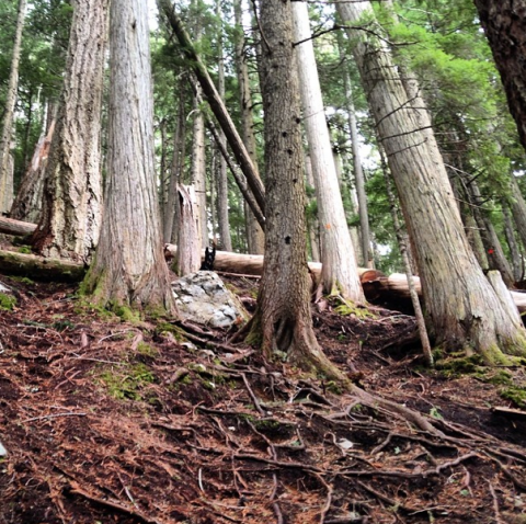
    And the familiar old one that you meet up with later:
    Emily Haggar Wedge

    The snow line is under 3000ft here, as the valley doesn't get much sun, and as usual in the spring, the melting snow uses the trail as the quickest way down the mountain. It's very muddy and wet, but the forest right around the trail was gorgeous as always.