




• Weekly avalanche conditions report
    Weekly Episode

    Avalanche Conditions Report

    Weekly snowpack summary covering Rogers Pass, the Selkirks and the Canadian Rockies. Published every Friday throughout the season.

    Listen Now →

    Weekly avalanche & safety updates throughout the season

  • BSC Guide Books
    Proprietary Content

    BSC Guide Books & Maps

    Researched and written by our team. Printed guides and georeferenced digital maps for Canada's best backcountry terrain.

    Shop the Store →

    Printed guides + georeferenced digital maps — all authored by BSC

  • BSC Membership

    Access 300+
    Full Routes

    Subscribe to Backcountry Skiing Canada and unlock complete route descriptions, trailhead details, approach beta, seasonal conditions and linked digital maps — for every route we've documented across Western Canada.

    • 300+ full route descriptions with trailheads, approach notes and descent options
    • Georeferenced digital maps — Gaia GPS and CalTopo compatible
    • ATES-rated and updated each season with current conditions beta
    • Support independent backcountry skiing content since 2009
    Subscribe to BSC Browse free content →

    Route details also available in BSC printed guidebooks

  • Know Before You Go

    Check Today's Forecast

    Real-time avalanche danger ratings updated daily by Avalanche Canada. Always check before heading out.

    View Forecast →

    Avalanche awareness saves lives

  • Know Before You Go

    Check Today's Forecast

    Real-time avalanche danger ratings updated daily by Avalanche Canada. Always check before heading out.

    View Forecast →

    240+ videos — gear reviews, conditions reports & backcountry edits

LOGIN

New App helps make better terrain choices

  • 2024-02-17 15:22:45
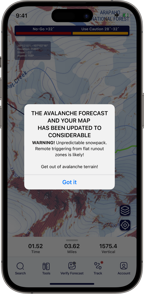
    Aspect Avy claims to help users make better decisions in the back country. This app has been created by a team including Jeff Banks, an IFMGA mountain guide for the last 18 years. When discussing avalanche problems, it is generally understood that "terrain is the answer". What this app does is to make it easy to see the terrain that is above a certain slope angle, and make it easy to see. This gives a really clear picture of avalanche terrain, allowing the user to plot a route that avoids it. Unfortunately, as an Android user, I was unable to download the app to use it myself on my next tour.

    The next piece to the puzzle in avalanche terrain is group decision making. Aspect Avy has created a real time decision making app. The user can be warned about changes in the forecast, and even submit observations on the fly to help make good choices. The creators of the app stress that their reasoning behind creating it is to enable backcountry users to be safer. Having done an AST course, you can then use this app as a script to run through the processes that have been learned in the course. This should enable a step by step script to follow and cut down on the sublectivity of making a go or no go decision.
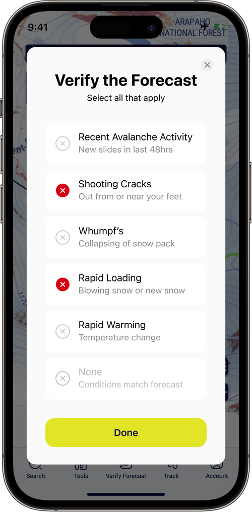


    This Apps seems to be a useful aid to making decisions to go or not go, as well as helping to make good terrain choices. I'm hoping it comes out on Android soon, for those of us that are not Iphone users, so I can try it out.